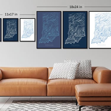
Indiana decorative hydrological map print: 11x17, 18x24 or 36x48 (split in two 24x36 in prints) indiana decorative hydrological map print 11x17 18x24 36x48 split 24x36 prints
A highly detailed hydrological map of every drain, ditch, stream, creek and river in Indiana, hand drawn using publicly available...
Product InfoWild Places Prints
Washington, DC
Anna Maria Island Sound digital watercolor 24x36 inches bathymetric map, including Tampa Bay and surrounding waterways anna maria island sound digital watercolor 24x36 inches bathymetric map including tampa bay surrounding waterways
A digital watercolor painting of Anna Maria Sound, Anna Maria Island, and surrounding areas and waterways, including parts of Tampa...
Product InfoWild Places Prints
Washington, DC
Barney Circle/Hill East Washington DC neighborhood map art print 11x17 barney circlehill east washington neighborhood map art print 11x17
An 11x17 inch decorative map print of SE Washington DC's Barney Circle/Hill East neighborhood. All DC neighborhood maps are printed...
Product InfoWild Places Prints
Washington, DC
Fort Totten DC neighborhood map print 11x17 fort totten neighborhood map print 11x17
An 11x17 inch decorative map print of Washington DC's Fort Totten neighborhood. All DC neighborhood maps are printed by me...
Product InfoWild Places Prints
Washington, DC
Mason Neck State Park, Virginia, decorative 11x17 map print mason neck state park virginia decorative 11x17 map print
A detailed decorative map print of Mason Neck State Park in Virginia, part of a series I’ve been working on...
Product InfoWild Places Prints
Washington, DC
Marshall Heights Washington DC neighborhood map art print 11x17 Civic Betterment Capitol View marshall heights washington neighborhood map art print 11x17 civic betterment capitol view
An 11x17 inch decorative map print of SE Washington DC's Marshall Heights + Civic Betterment and Capitol View neighborhoods. All...
Product InfoWild Places Prints
Washington, DC
Logan Circle 11x17 Washington DC neighborhood map print logan circle 11x17 washington neighborhood map print
An 11x17 inches decorative map print of NW Washington, D.C.'s Logan Circle neighborhood. All 11x17 prints are printed by me...
Product InfoWild Places Prints
Washington, DC
Brentwood DC neighborhood map print 11x17 inches brentwood neighborhood map print 11x17 inches
An 11x17 inches decorative map print of Northeast Washington DC's Brentwood neighborhood. Add a custom label to your DC neighborhood...
Product InfoWild Places Prints
Washington, DC
Bellevue SE and SW Washington DC neighborhood map art print 11x17 bellevue washington neighborhood map art print 11x17
An 11x17 inch decorative map print of Southeast and Southwest Washington DC's Bellevue neighborhood. All DC neighborhood maps are printed...
Product InfoWild Places Prints
Washington, DC
Shepherd Park Northwest Washington DC neighborhood map art print 11x17 shepherd park northwest washington neighborhood map art print 11x17
An 11x17 inch decorative map print of Northwest Washington DC's Shepherd Park neighborhood. All DC neighborhood maps are printed by...
Product InfoWild Places Prints
Washington, DC
ATTIC Premium for Stores
If you want your store and your products to stand out, then ATTIC Premium is for you. Add your logo, link to your social media accounts, receive a rank boost and much more. Plans starting at only $3/month.
View the benefits of ATTIC Premium
ATTIC
Shop Local, Shop Small
Crestwood DC neighborhood map 11x17 inch crestwood neighborhood map 11x17 inch
An 11x17 inch decorative map print of NW Washington DC's Crestwood neighborhood. All DC neighborhood maps are printed on high...
Product InfoWild Places Prints
Washington, DC
Arboretum DC neighborhood map print 11x17 arboretum neighborhood map print 11x17
An 11x17 inch decorative map print of Northeast Washington DC's Arboretum neighborhood and the surrounding National Arboretum. 11x17 in maps...
Product InfoWild Places Prints
Washington, DC
Kalorama 11x17 inches neighborhood map Washington DC kalorama 11x17 inches neighborhood map washington
An 11x17 inches decorative map print of Washington DC's Kalorama neighborhood. All 11x17 prints are printed by me on premium...
Product InfoWild Places Prints
Washington, DC
Great Monarch Migration map 18x24 science art poster monarch migration map 18x24 science art poster
An 18x24 in scientific art poster of the great multi-generational monarch butterfly migration from the United States and southern Canada...
Product InfoWild Places Prints
Washington, DC
Wesley Heights Northwest Washington DC neighborhood map art print 11x17 inches wesley heights northwest washington neighborhood map art print 11x17 inches
An 11x17 inch decorative map print of Northwest Washington DC's Wesley Heights neighborhood. All DC neighborhood maps are printed by...
Product InfoWild Places Prints
Washington, DC
Spruce Knob-Seneca Rocks-Dolly Sods Wilderness topographic art prints, 2x6ft (3 colors available); West Virginia spruce knobseneca rocksdolly sods wilderness topographic art prints 2x6ft colors available west virginia
Two 24x36 inches topographical map prints of West Virginia's Spruce Knob/Seneca Rocks National Recreation Area and the Dolly Sods Wilderness...
Product InfoWild Places Prints
Washington, DC
Bloomingdale DC neighborhood map 11x17 decorative map print bloomingdale neighborhood map 11x17 decorative print
An 11x17 inches decorative map print of Northwest Washington, DC's Bloomingdale neighborhood. All 11x17 prints are printed by me on...
Product InfoWild Places Prints
Washington, DC
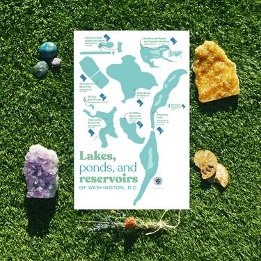
Lakes, ponds, and reservoirs of Washington, DC map lakes ponds reservoirs washington map
A map of the lakes, ponds, and reservoirs in Washington, D.C. All 11x17 maps are printed by me on high...
Product InfoWild Places Prints
Washington, DC
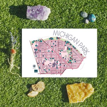
Michigan Park DC neighborhood map print 11x17 michigan park neighborhood map print 11x17
An 11x17 inch decorative map print of Northeast DC's Michigan Park neighborhood. All 11x17 maps are printed by me on...
Product InfoWild Places Prints
Washington, DC
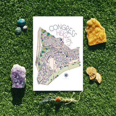
Congress Heights Southeast Washington DC neighborhood map art print 11x17 congress heights southeast washington neighborhood map art print 11x17
An 11x17 inch decorative map print of Southeast Washington DC's Congress Heights neighborhood. All DC neighborhood maps are printed by...
Product InfoWild Places Prints
Washington, DC
ATTIC Premium for Stores
If you want your store and your products to stand out, then ATTIC Premium is for you. Add your logo, link to your social media accounts, receive a rank boost and much more. Plans starting at only $3/month.
View the benefits of ATTIC Premium
ATTIC
Shop Local, Shop Small
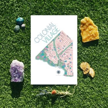
Colonial Village Northwest Washington DC neighborhood map art print 11x17 colonial village northwest washington neighborhood map art print 11x17
An 11x17 inch decorative map print of Northwest Washington DC's Colonial Village neighborhood. All DC neighborhood maps are printed by...
Product InfoWild Places Prints
Washington, DC
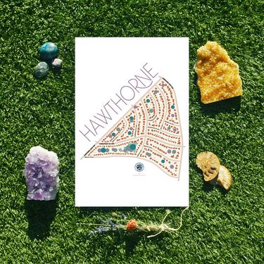
Hawthorne Northwest Washington DC neighborhood map art print 11x17 hawthorne northwest washington neighborhood map art print 11x17
An 11x17 inch decorative map print of far upper Northwest Washington DC's Hawthorne neighborhood. All DC neighborhood maps are printed...
Product InfoWild Places Prints
Washington, DC
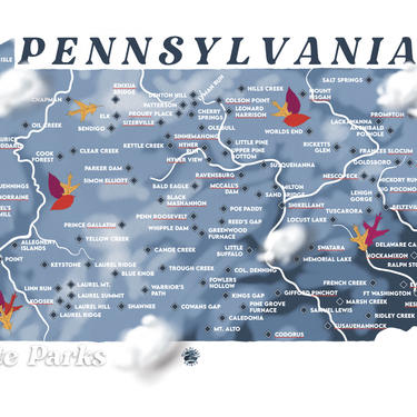
Pennsylvania State Parks 11x17 in art map print pennsylvania state parks 11x17 art map print
A digital painting of Pennsylvania’s numerous State Parks. Background colors reflect elevation. This 11x17 inches print was drawn by hand...
Product InfoWild Places Prints
Washington, DC
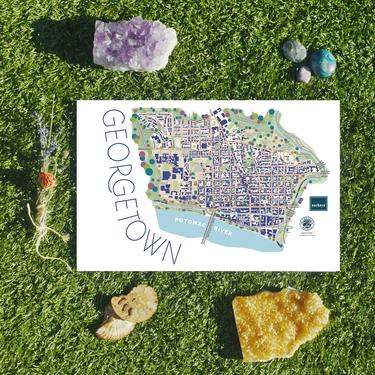
Georgetown DC neighborhood map art print Burleith Washington DC map 11x17 georgetown neighborhood map art print burleith washington 11x17
An 11x17 inch decorative map print of NW Washington DC's Georgetown and Burleith neighborhoods. All DC neighborhood maps are printed...
Product InfoWild Places Prints
Washington, DC
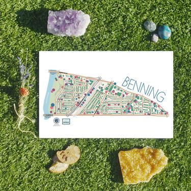
Benning/River Terrace Washington DC neighborhood map art print benningriver terrace washington neighborhood map art print
An 11x17 inch decorative map print of NE Washington DC's Benning neighborhood, plus River Terrace. All DC neighborhood maps are...
Product Info

